|
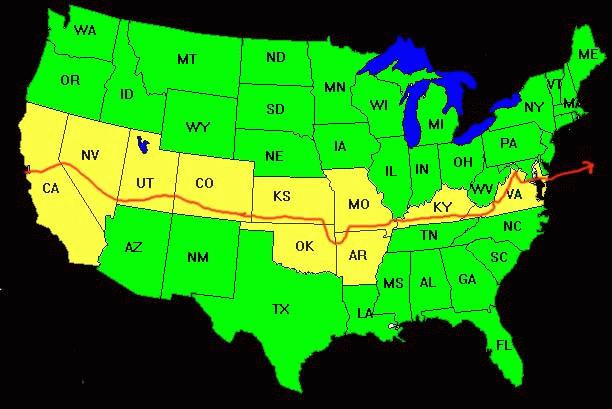
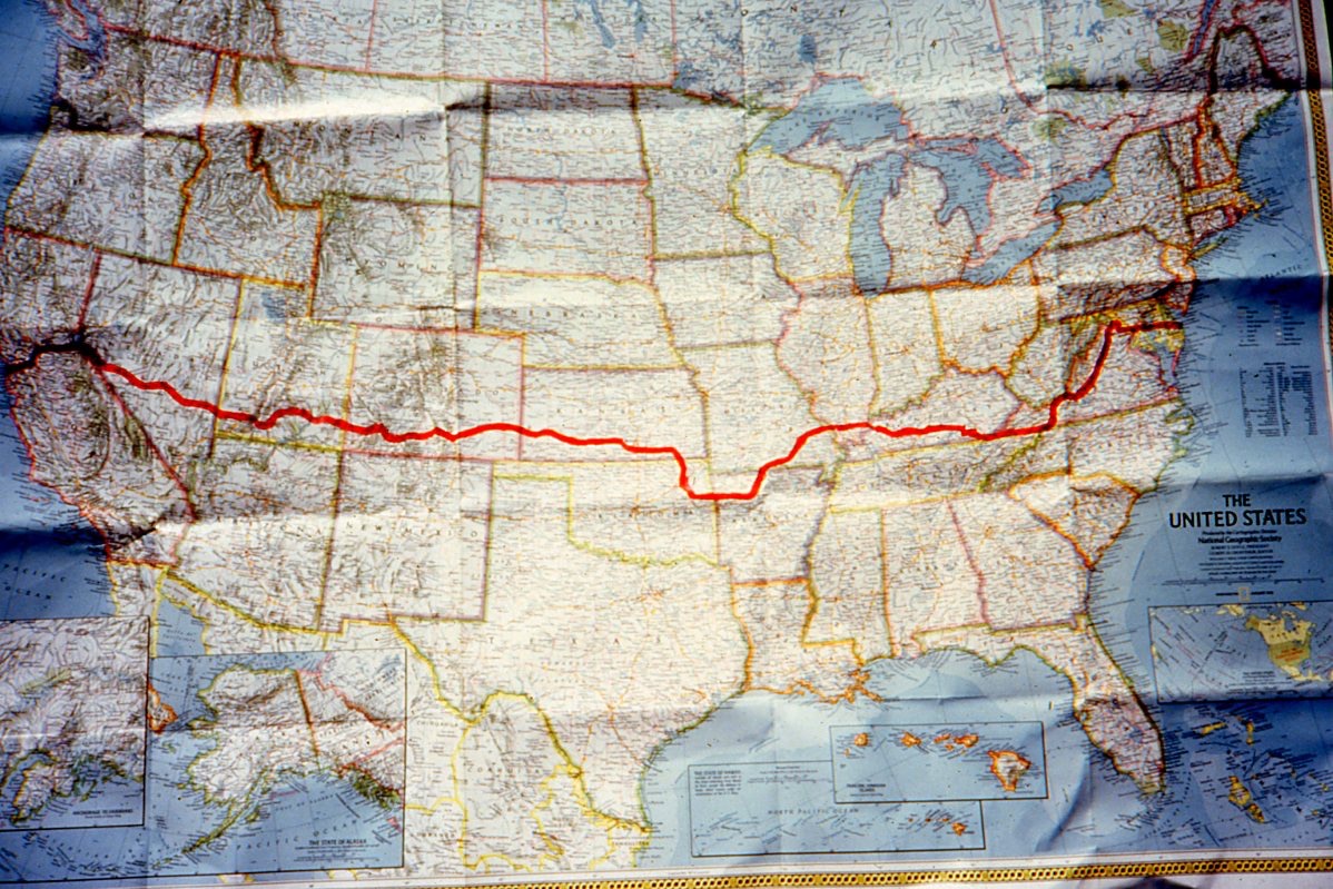
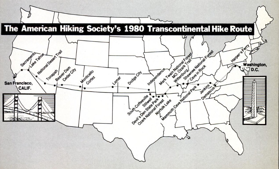
HikaNation was a 14-month cross-country backpacking trip
starting at Golden Gate Park in San Francisco, California on April 12, 1980, and ending at Cape Henlopen, Delaware on May 27, 1981 after traversing over 4,286 miles and passing through 14 states and Washington, D.C. The Progression of HikaNation details the journey with various organizational memos, letters, newspaper and magazine articles.
Bruce Ohlson compiled the closest thing we have to an official HikaNation mileage log: Bruce Ohlson's HikaNation Stats.
Campsite lists:
1. Linda, Keith, & John's list
2. William's list
3. Incomplete compilation list
|

The Route
Click images for larger versions.
|
|
|
|
Many thanks to
the map contributors:
Bruce Ohlson, Tim Geoghegan, Al Schneider, Janet Parsons,
Linda Hull, Keith Wright,
Susan "Butch" Henley.
Also thanks to Rich Warnick
for his interactive map
of the Utah route:
HikaNation 1980
Backpack Route - Utah:
HikaNation Utah ArcGIS
Online "story map"
|
|
The HikaNation Story

Jim Kern
How It Began
Mike McReynolds
|
|

|
|
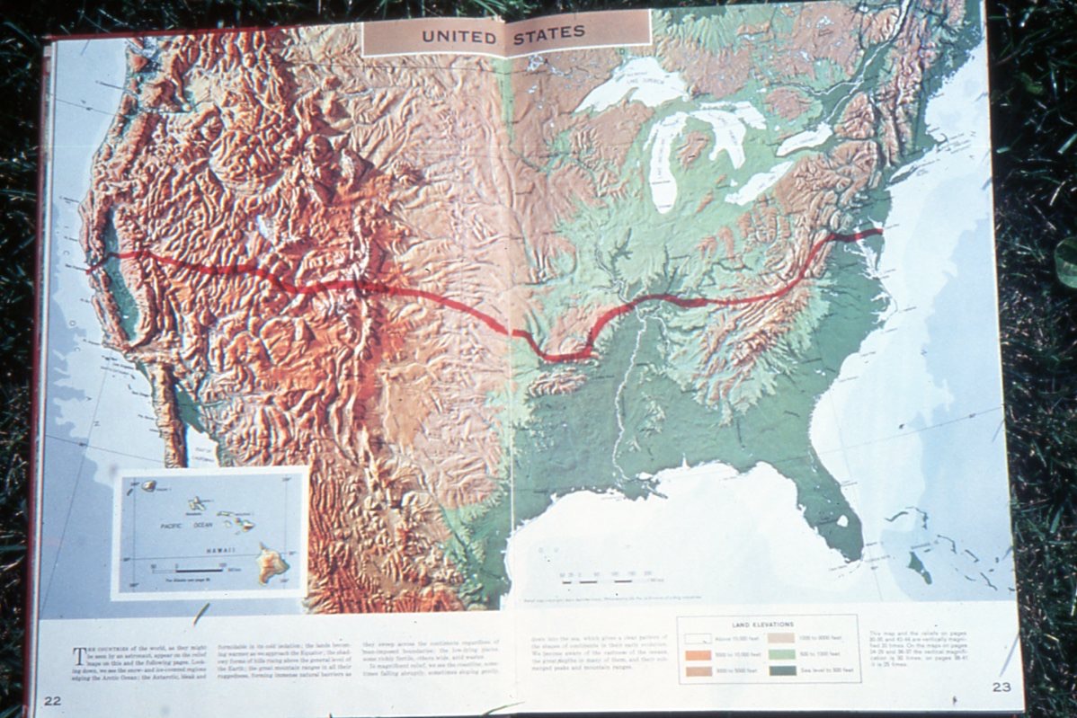
California
April 12 - May 6, 1980
California Route information
~ 277 miles with
~ 13.00 miles/walking day
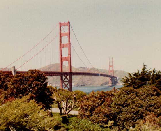
W. Ewart's California photos
...& even more photos |
California
April 12 - May 6, 1980

...another map of California |
|
|
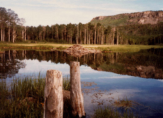
Nevada
May 6 - June 13, 1980
Nevada Route information
~ 418 miles with
~ 12.78 miles/walking day
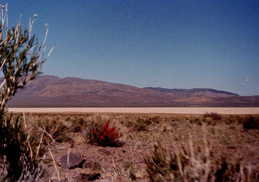
W. Ewart's Nevada photos
...& even more photos |
Nevada
May 6 - June 13, 1980
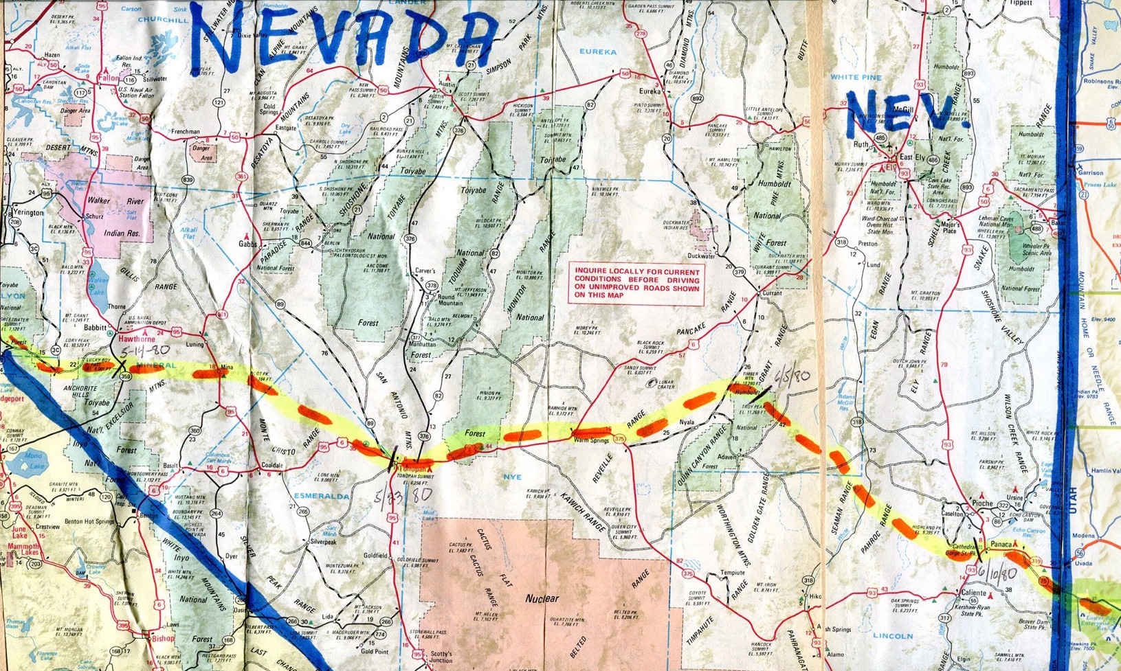
...another map of Nevada |
|
|
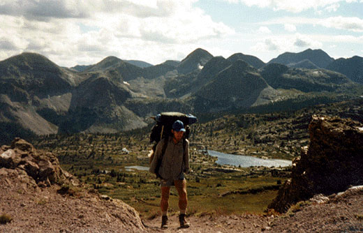
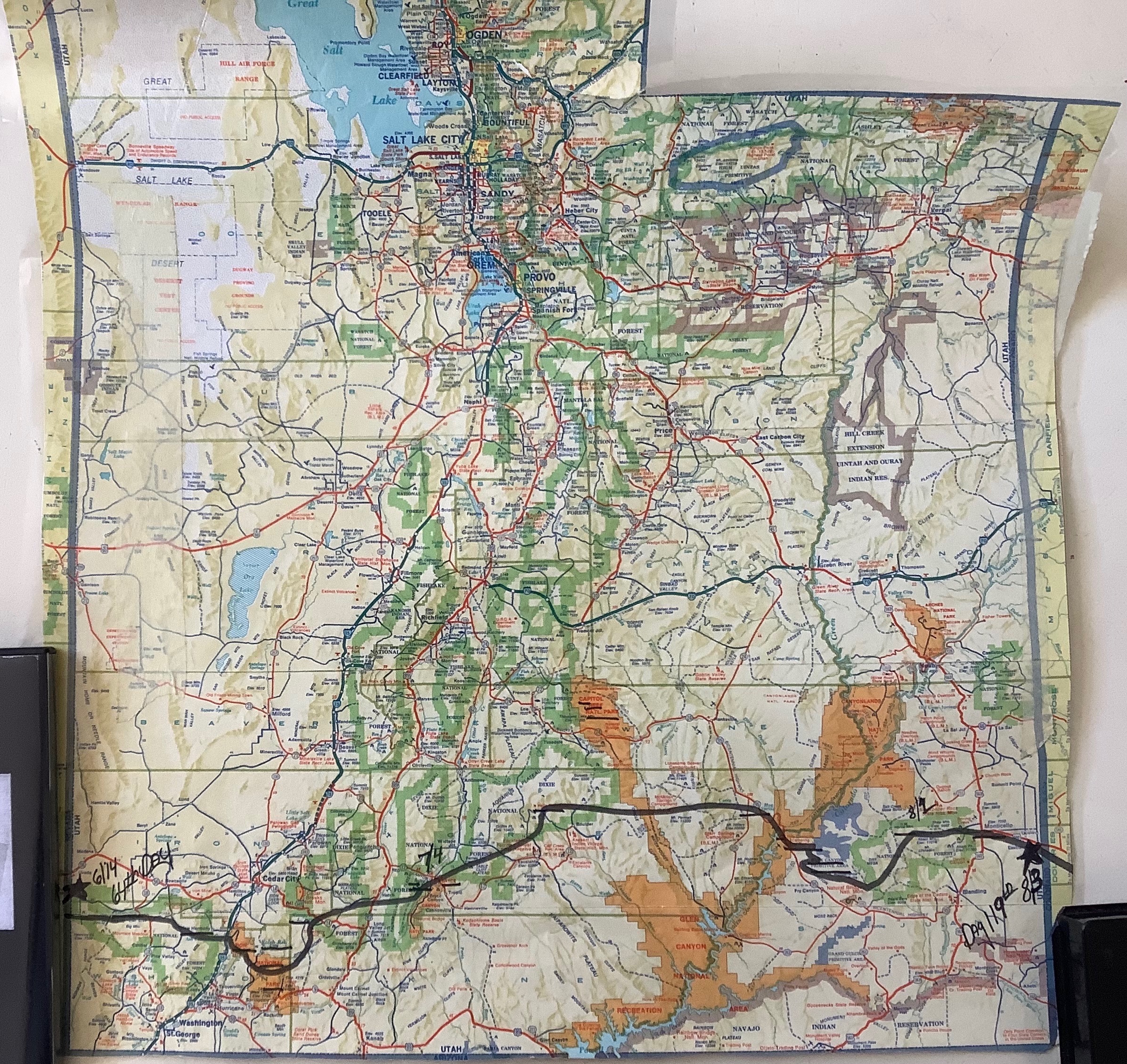
Utah
June 13 - August 5, 1980
Route information
~ 473 miles with
~ 10.51 miles/walking day
W. Ewart's Utah photos
...& even more photos |
Utah
June 13 - August 5, 1980

...another map of Utah PLUS - Rich Warnick's Interactive Utah Map PLUS - Rich Warnick's Interactive Utah Map |
|
|
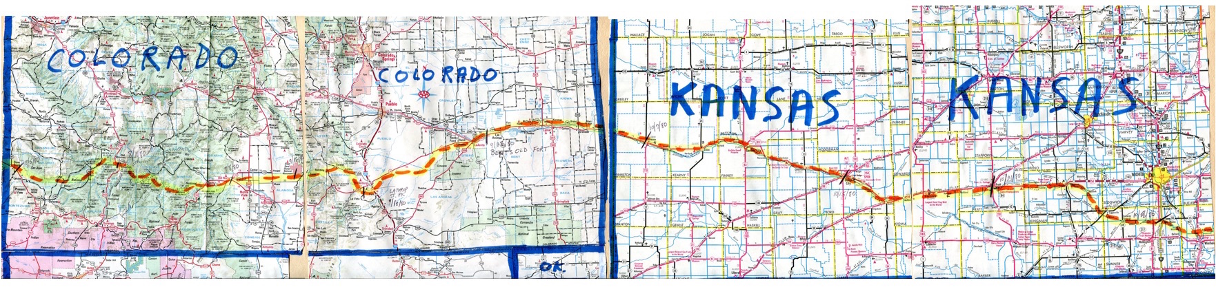
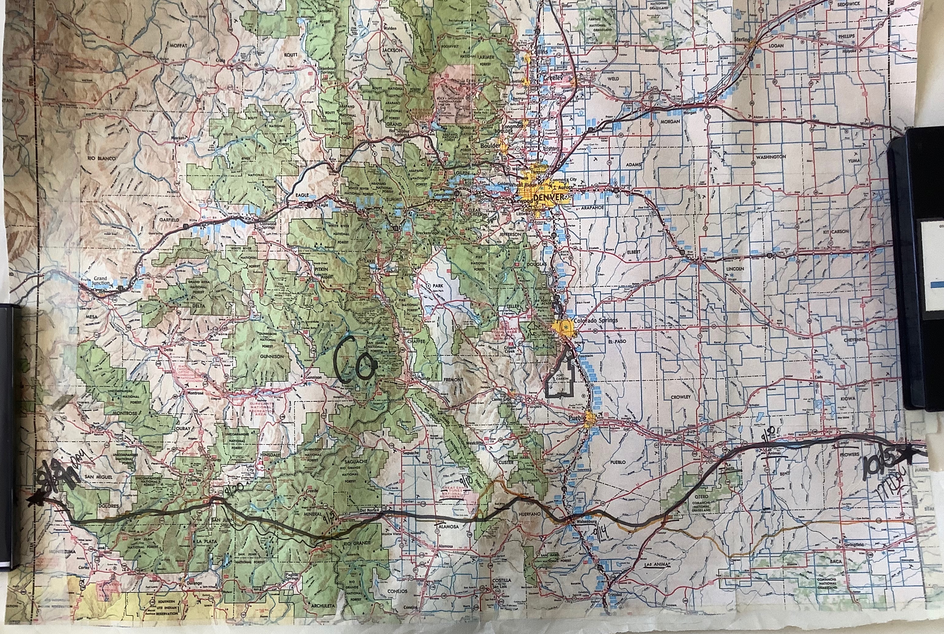
Colorado
August 5 - October 8, 1980
Route information
~ 564 miles with
~ 12.13 miles/walking day
W. Ewart's Colorado photos
...& even more photos |
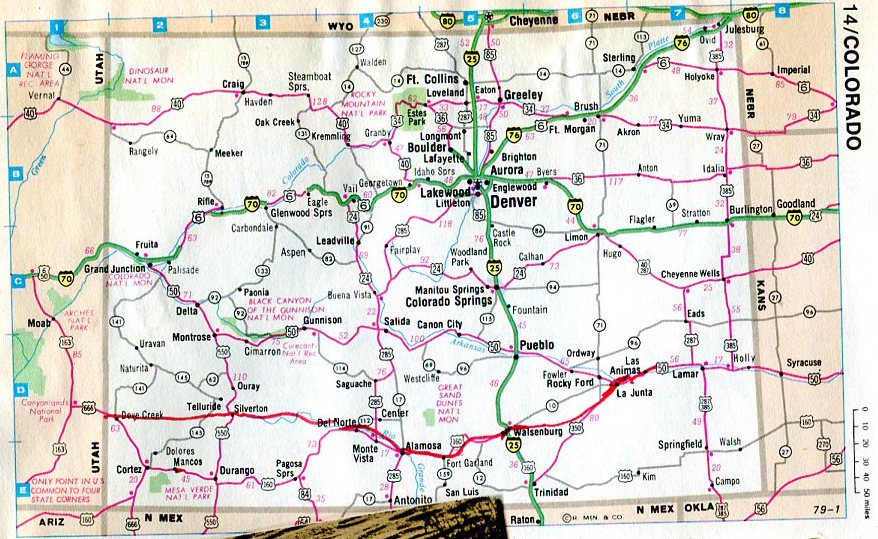
Colorado
August 5 - October 8, 1980
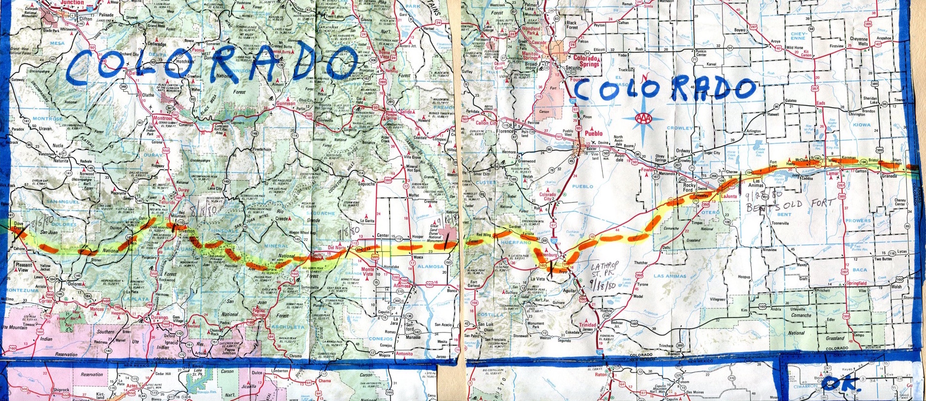
...another map of Colorado...& another Colorado map |
|
|
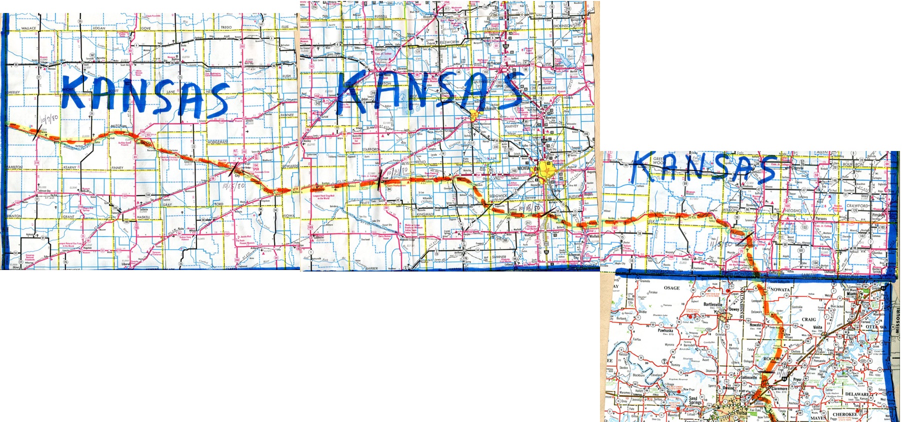
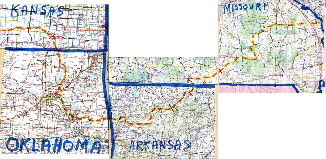
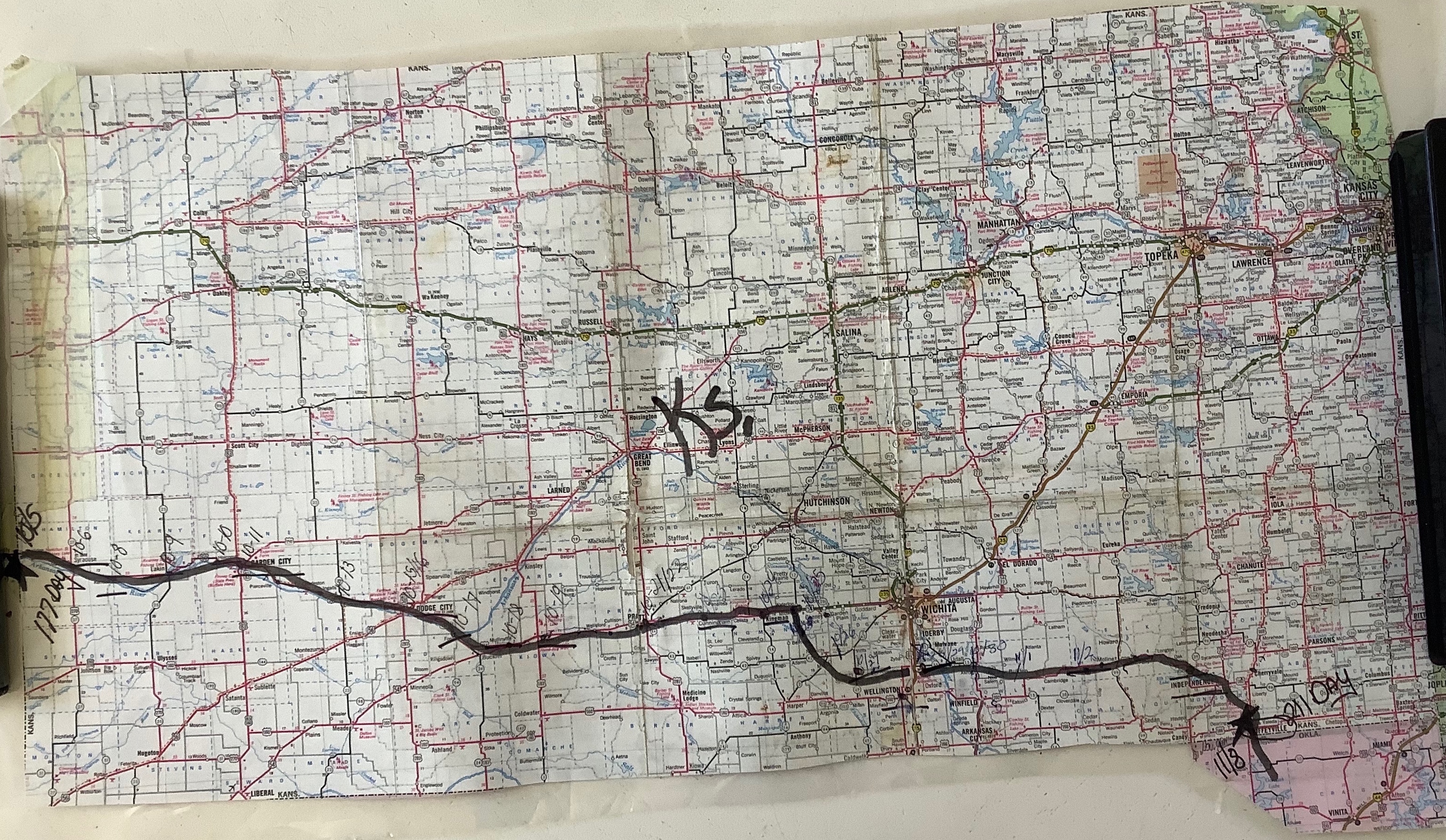
Kansas
October 8 - November 8, 1980
Route information
~ 434 miles with
~ 14.91 miles/walking day
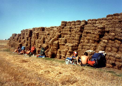
W. Ewart's Kansas photos
...& even more photos |
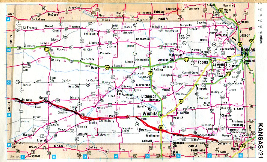
Kansas
October 8 - November 8, 1980
...another map of Kansas...& another Kansas map |
|
|
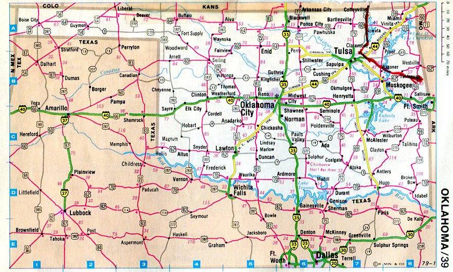
Oklahoma
Nov. 8 - Nov. 23, 1980
Route information
~ 194 miles with
~ 14.26 miles/walking day

W. Ewart's Oklahoma photos
...& even more photos |
Oklahoma
November 8 - November 23, 1980

...another Oklahoma map |
|
|
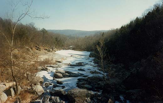
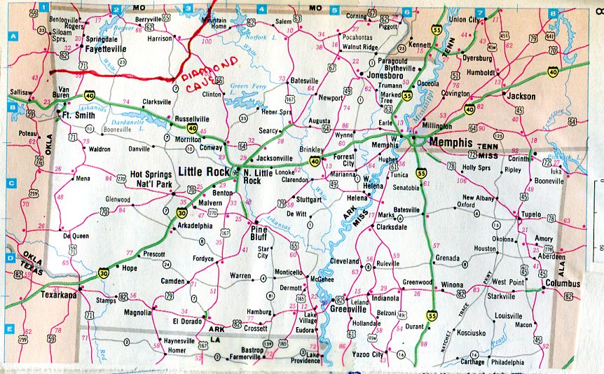
Arkansas
Nov. 23 - Dec. 20, 1980
Route information
~ 265 miles with
~ 11.73 miles/walking day

W. Ewart's Arkansas photos
...& even more photos |
Arkansas
November 23 - December 20, 1980
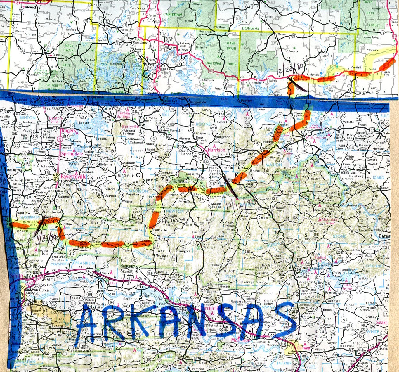
...another Arkansas map |
|
|
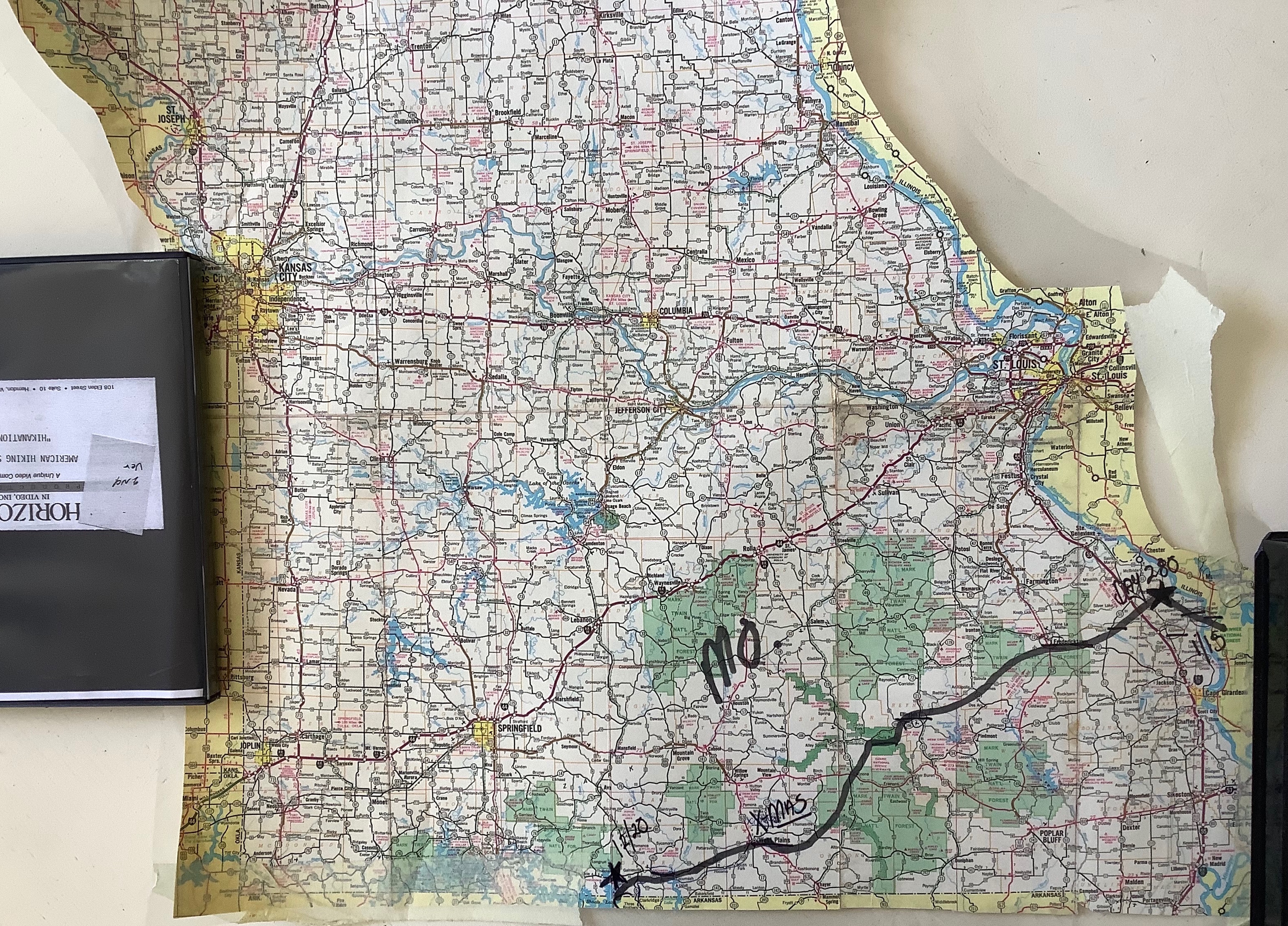
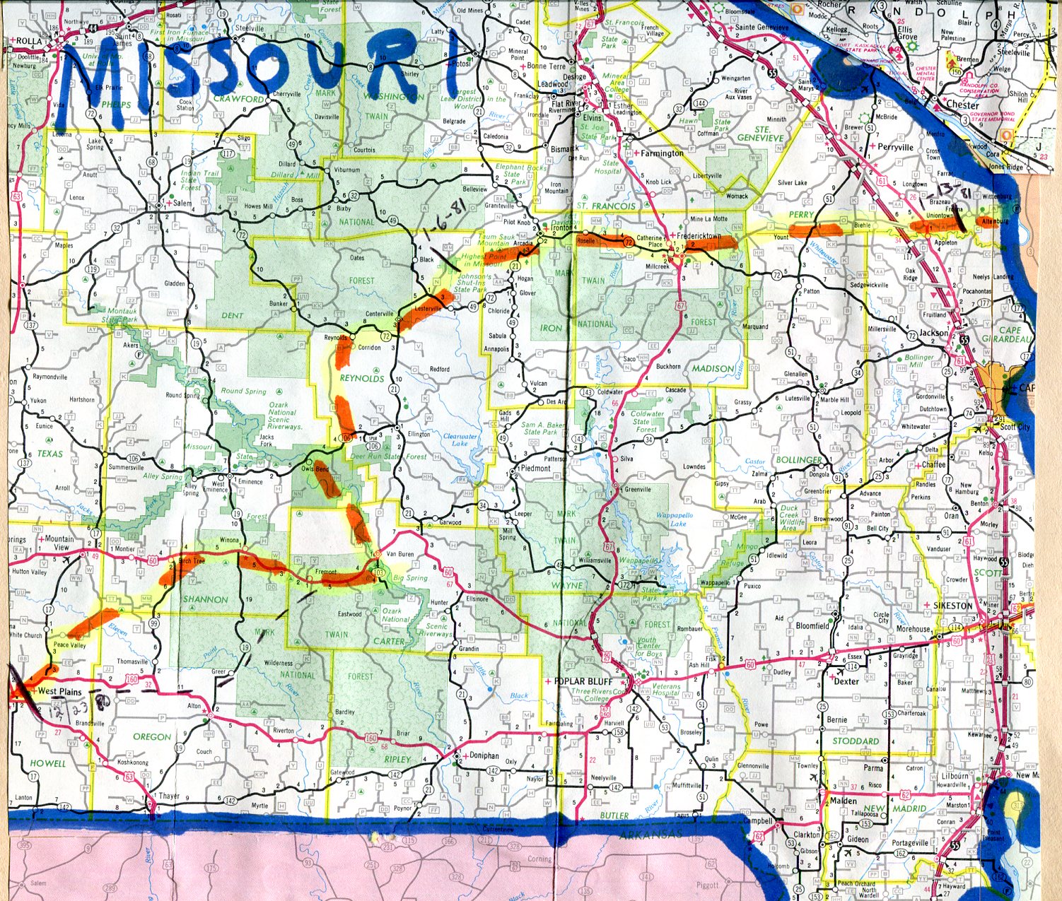
Missouri
Dec. 20, 1980 - Jan. 15, 1981
Route information
~ 282 miles with
~ 13.82 miles/walking day
W. Ewart's Missouri photos
...& even more photos |
Missouri
December 20, 1980 - January 15, 1981
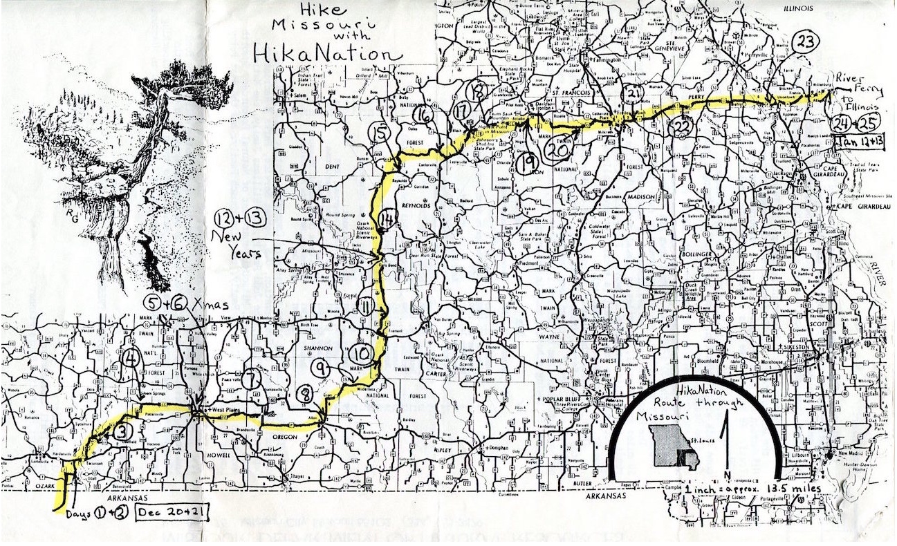
...another map of Missouri...& another Missouri map |
|
|
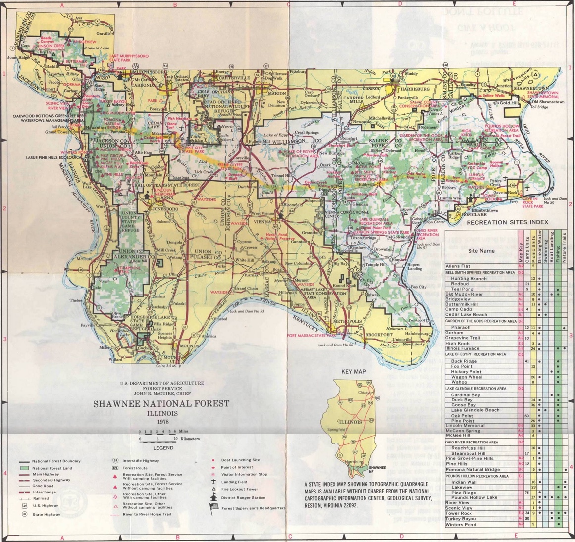
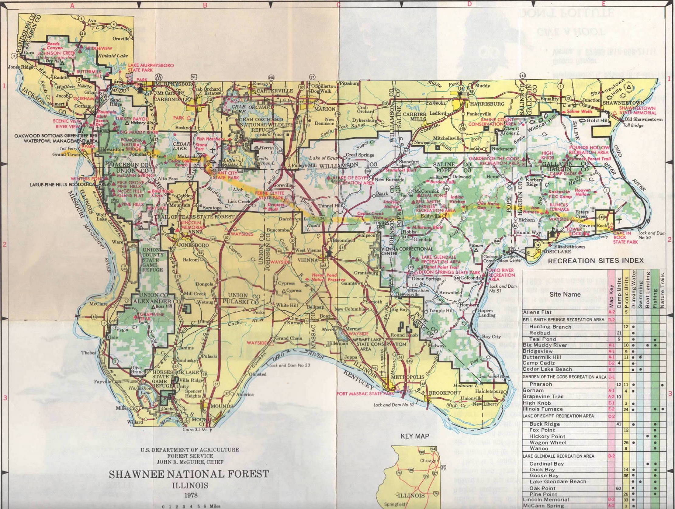
Illinois
January 15 - January 31, 1981
Route information
~ 137 miles with
~ 11.42 miles/walking day
W. Ewart's Illinois photos
...& even more photos |
Illinois
January 15 - January 31, 1981

...another Illinois map - version 1...another Illinois map - version 2 |
|
|
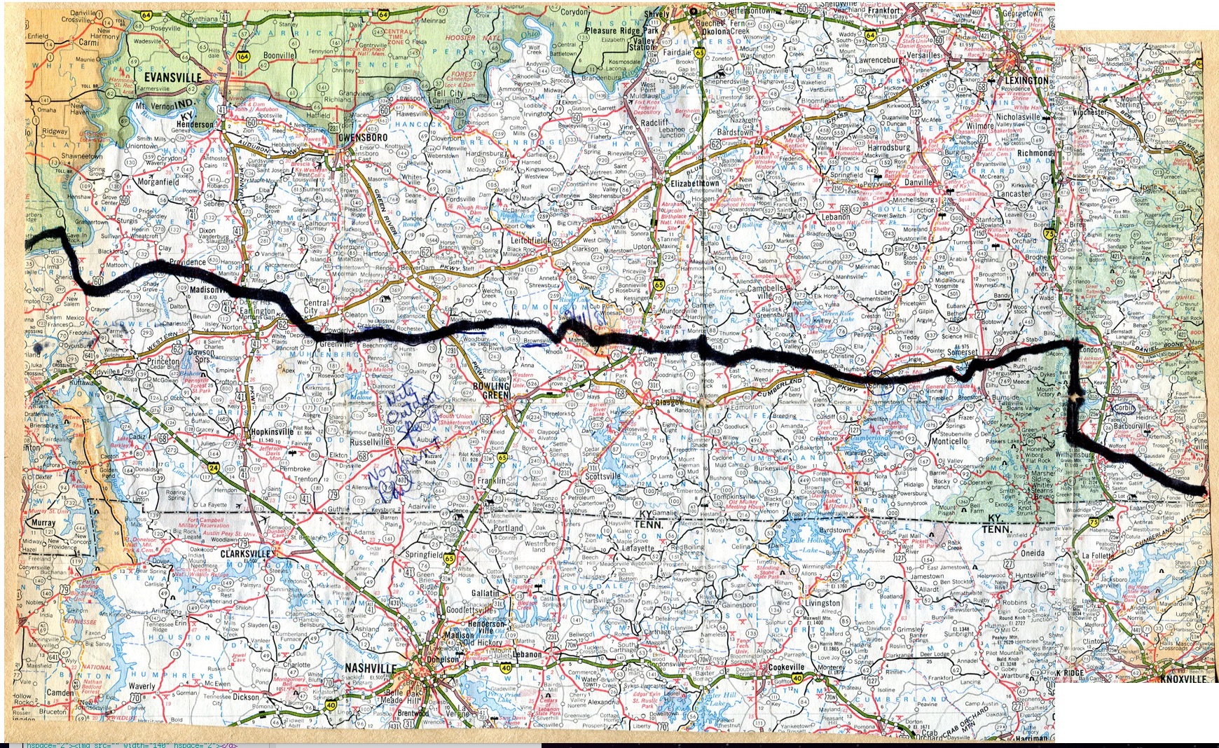
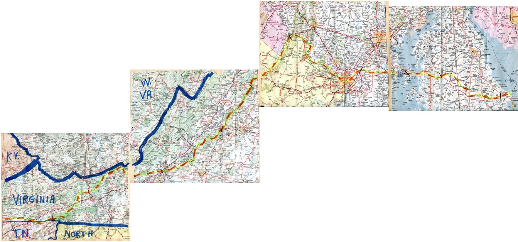
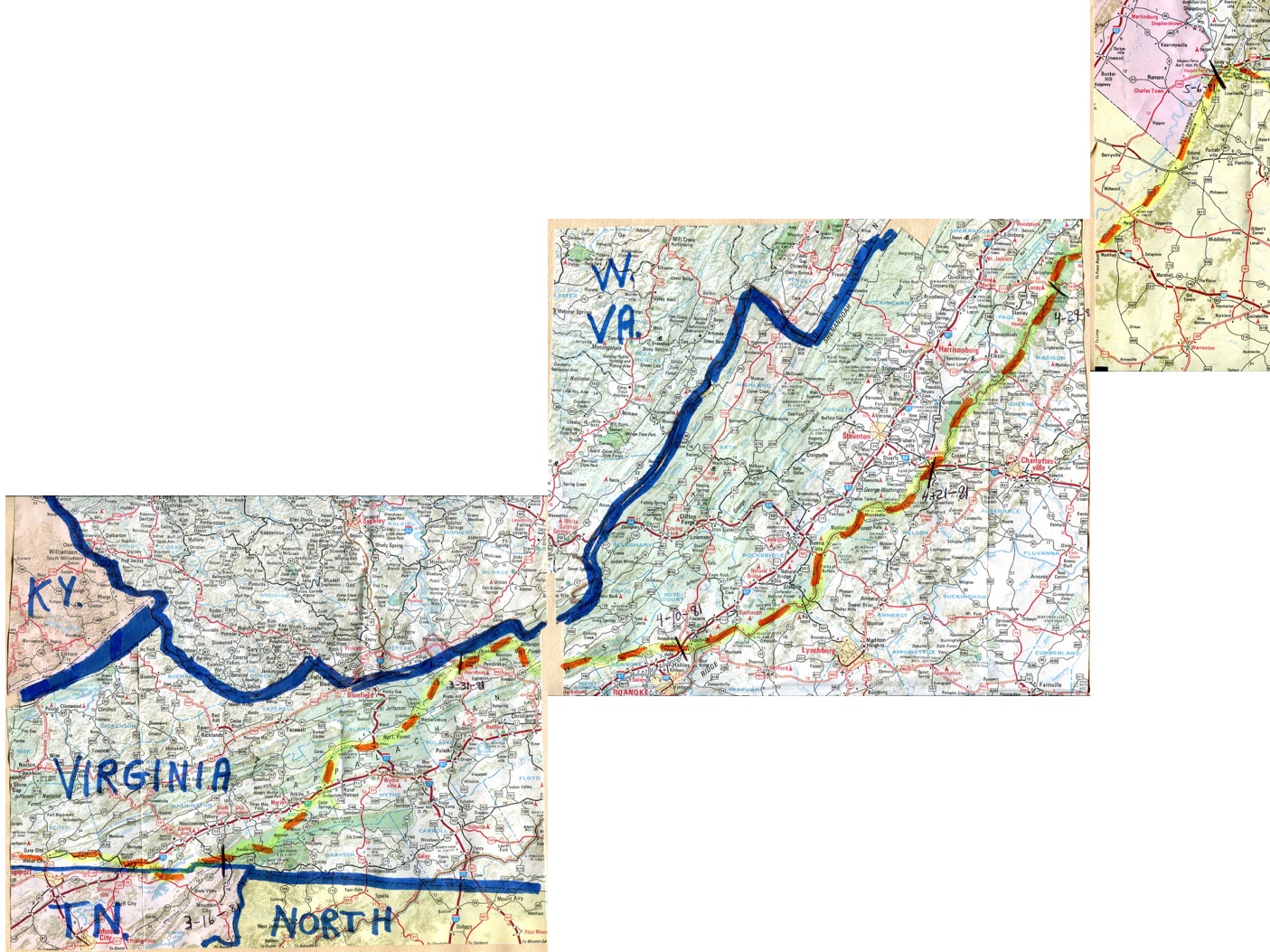
Kentucky
January 31 - March 9, 1981
Route information
Kentucky to A.T.
~ 518 miles with
~ 12.95 miles/walking day
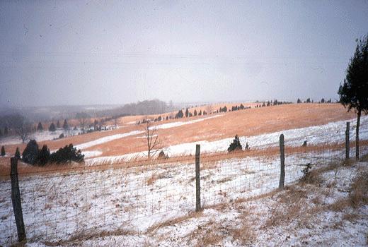
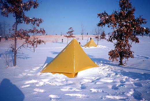
W. Ewart's Kentucky photos
...& even more photos |
Kentucky
January 31 - March 9, 1981
...another Kentucky map |
|
|
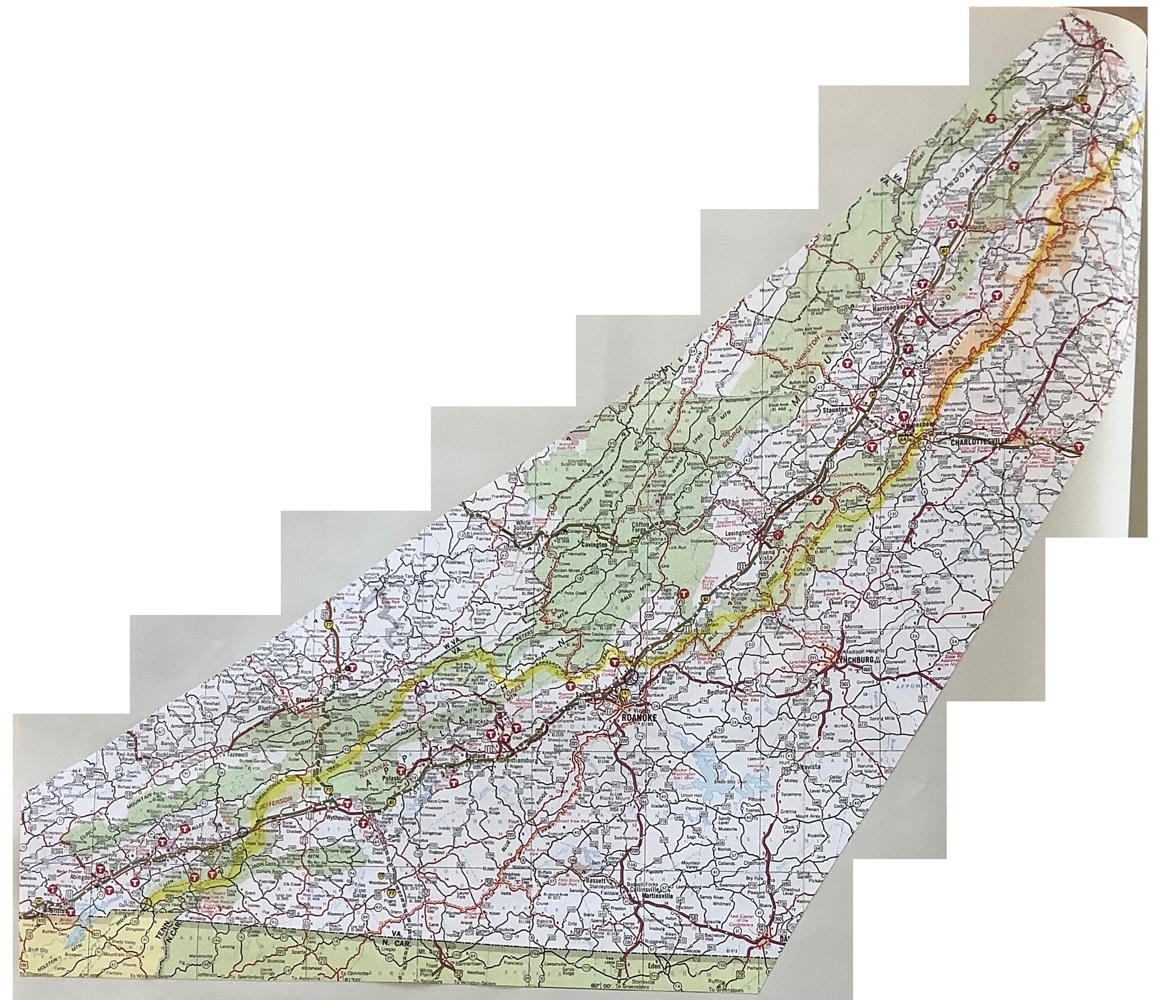
Virginia
March 9 - May 7, 1981
Route information
A.T. To C&O Canal
~ 585 miles with
~ 12.45 miles/walking day
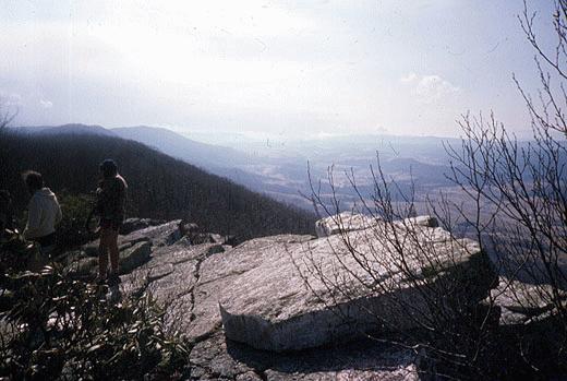
W. Ewart's Virginia photos
...& even more photos |
Virginia
March 9 - May 7, 1981
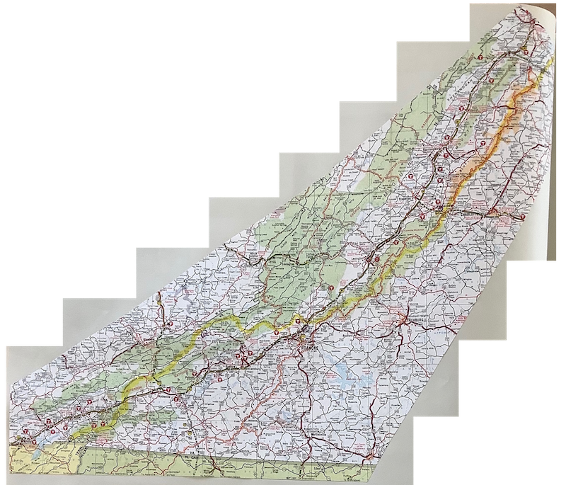
...another Virginia map...and yet another Virginia map |
|
|
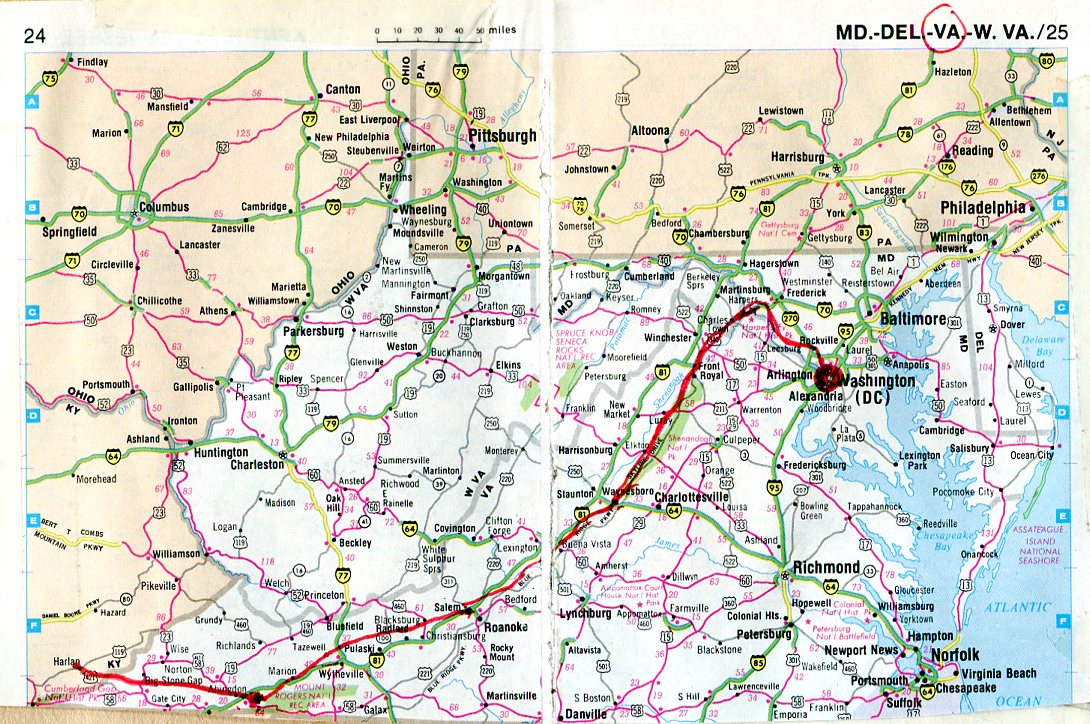
West Virginia
May 7 - May 9, 1981
Route information
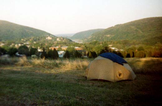
W. Ewart's W. Virg. photos
...& even more photos |
West Virginia
May 7 - May 9, 1981
...another West Virginia map |
|
|
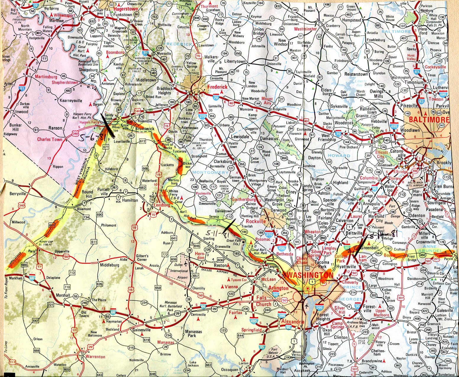
Maryland, before D.C.
May 9 - May 13, 1981
Route information
W. Ewart's Maryland photos
...& even more photos |
Maryland,
before Washington, D.C.
May 9 - May 13, 1981
|
|
|
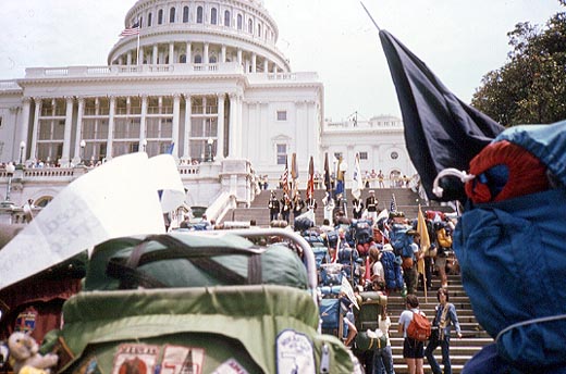
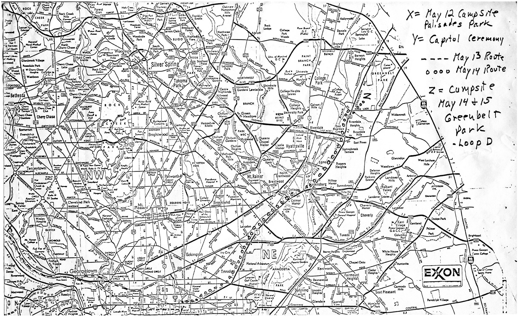
Washington, D.C.
May 13 - May 14, 1981
Route information
D.C. to Atlantic
~ 139 miles with
~ 11.58 miles/walking day
W. Ewart's D.C. photos
...& even more photos |
Washington, D.C.
May 13 - May 14, 1981
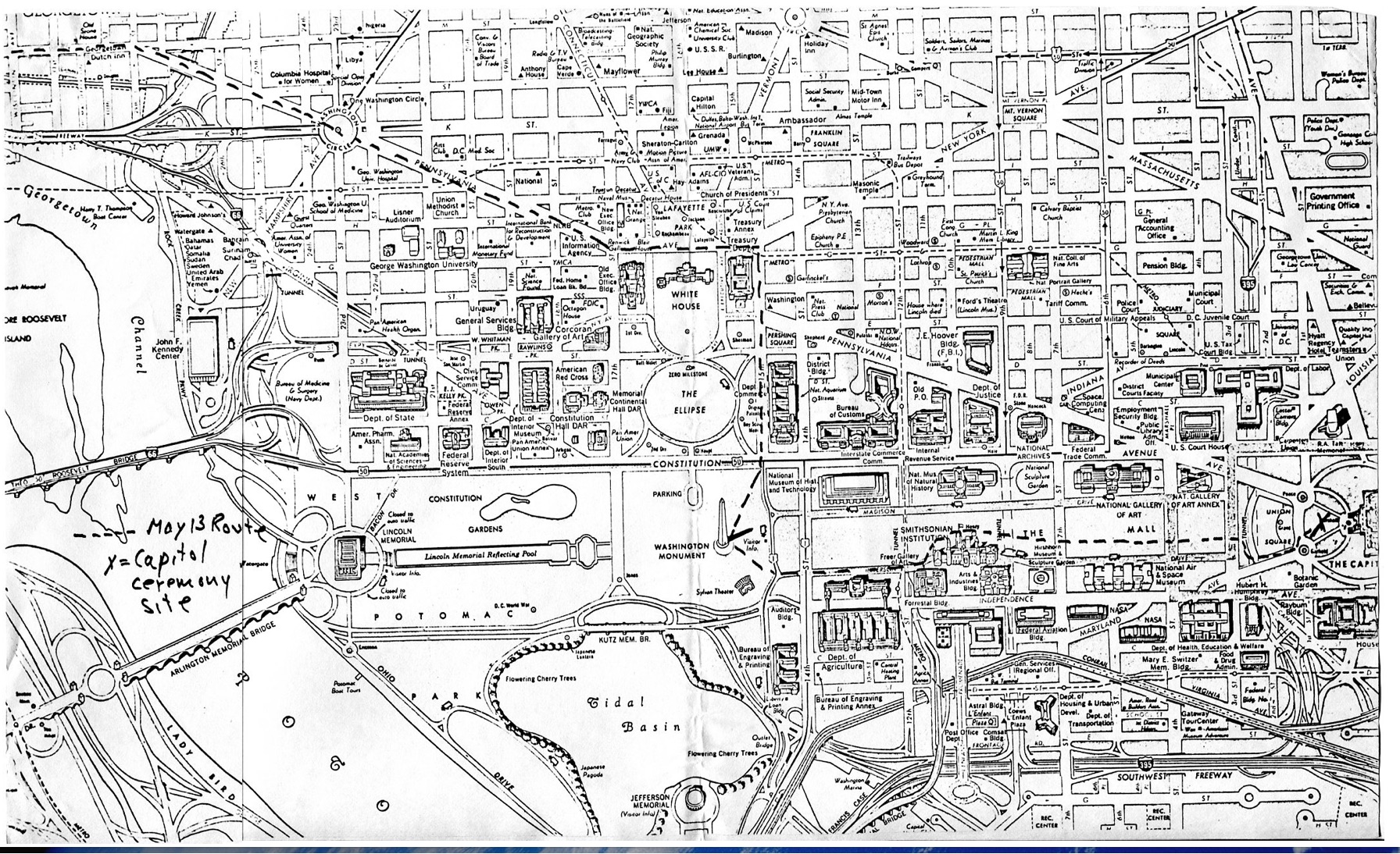
May 13th route (above)May 14th route (link) |
|
|
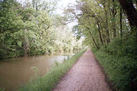
Maryland, after D.C.
May 14 - May 24, 1981
Route information
W. Ewart's Maryland photos
...& even more photos
|
Maryland,
after Washington, D.C.
May 14 - May 24, 1981
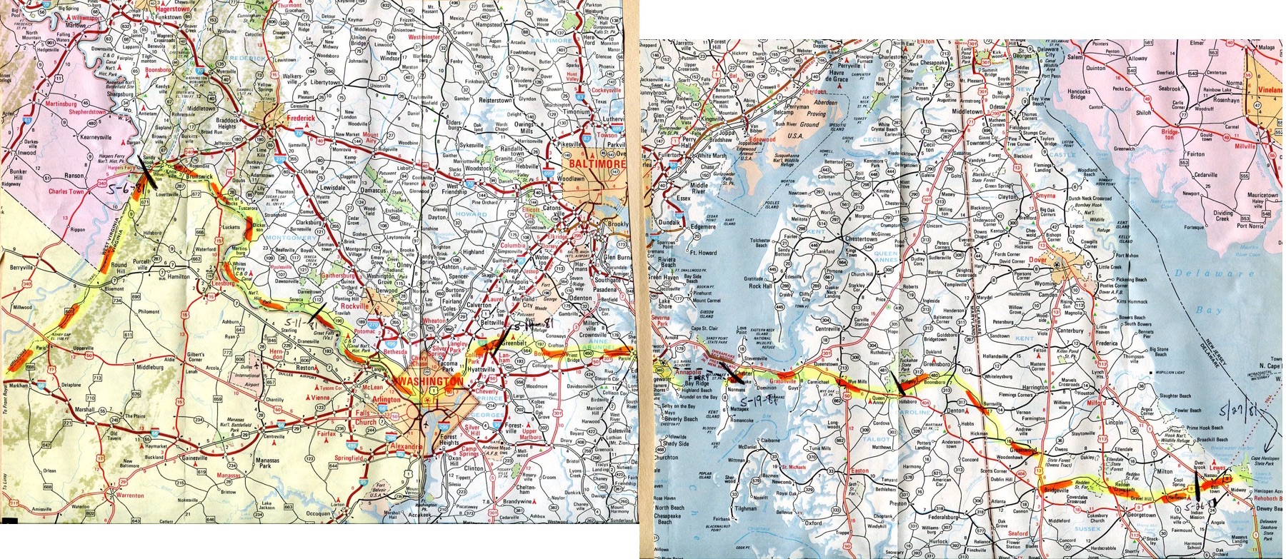
Additional maps and directions below:
|
|
|
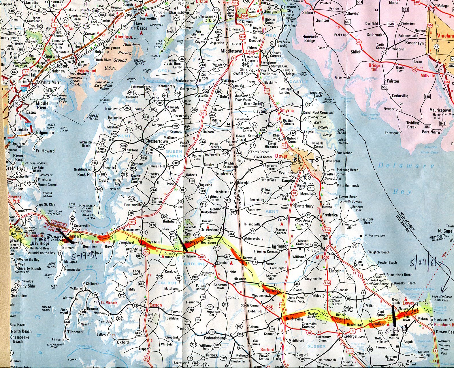
Delaware
May 24 - May 27, 1981
Route information
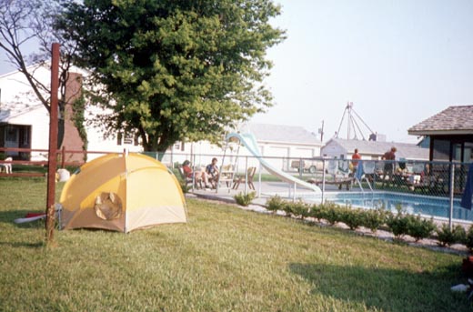
W. Ewart's Delaware photos
...& even more photos
Trip Total
Pacific Ocean to Atlantic Ocean
~ 4,286 miles with
~ 12.52 miles/walking day
|
Delaware
May 24 - May 27, 1981
|
|
|
|
|


