Kentucky map
Kentucky route information |
The Progression of HikaNation - Kentucky
details the journey with various organizational
memos, letters, newspaper and magazine articles. |
Unofficial Kentucky campsites

Unofficial HikaNation Campsites List
|
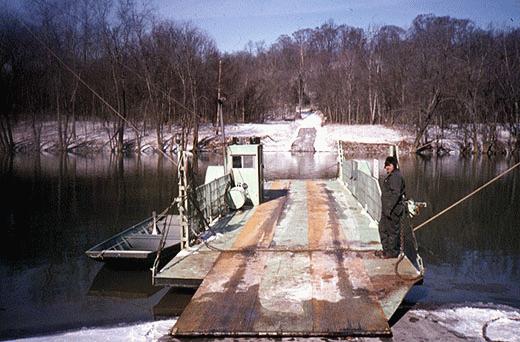
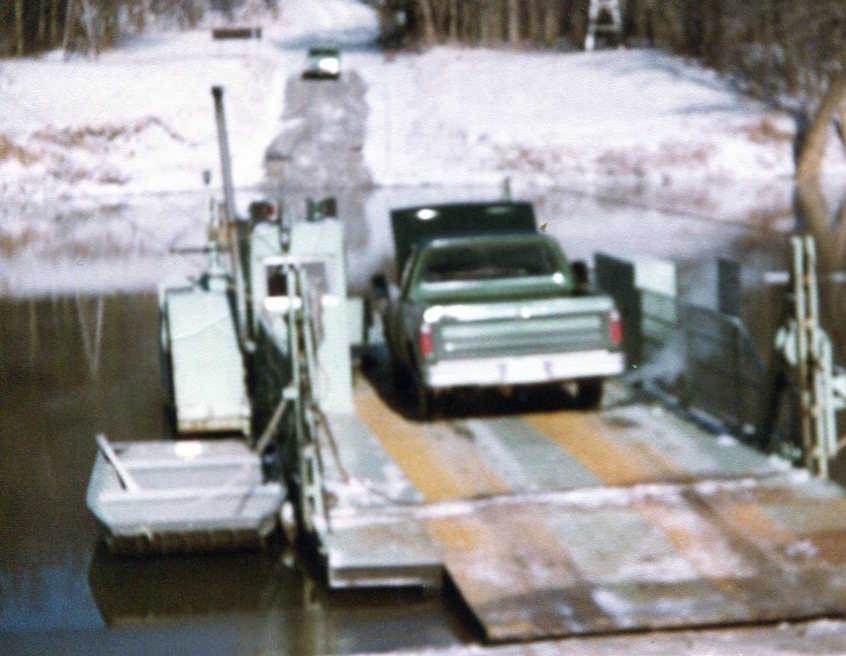
Boarding the Houchin Ferry
(photo by William Ewart) |
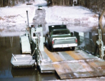
Boarding the Houchin Ferry
(photo by Marce Guerrein) |
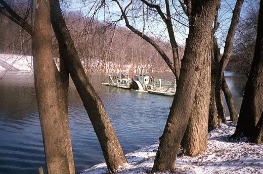
The Houchin Ferry
HikaNation's ride across the Green River
(photo by William Ewart) |
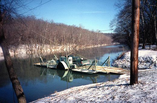
The Houchin Ferry on its way back
(photo by William Ewart) |
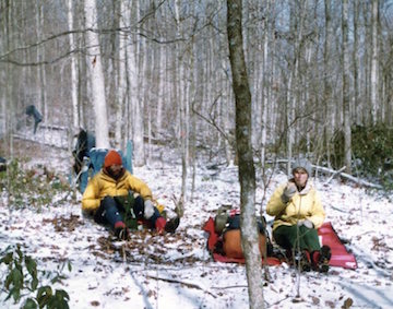
Keith Wright & Linda Hull
(photo by Marce Guerrein) |
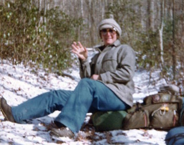
Cindy Bain
(photo by Marce Guerrein) |
Mammoth Cave National Park Map
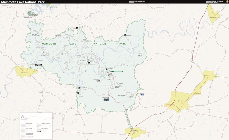 |
Houchin Ferry Campground and Collie Ridge Bluffs are within the Park. Unfortunately HikaNation's route
and my side trip and solo camp are not currently marked on the Mammoth Cave National Park Map.
The HikaNation group's route had them hiking from Houchin Ferry Campground to the Mammoth Cave National Park Campground today (Thursday), and then they spent 2 rest days there (Friday and Saturday).
I decided to take a different route and spent Thursday night near Collie Ridge Bluffs, in the backcountry. Friday I would catch up to the group and spend 1 rest day (Saturday) at the main campground.
|
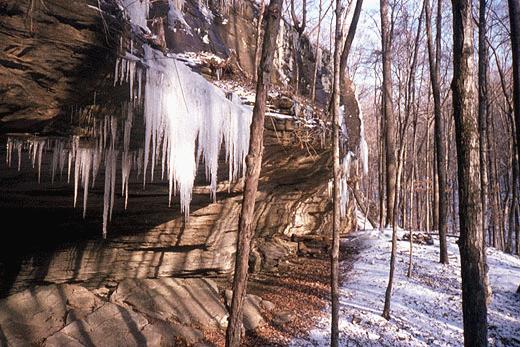
Collie Ridge Bluffs
(photo by William Ewart) |
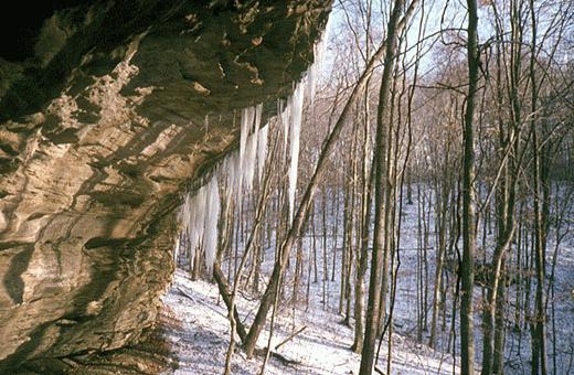
Collie Ridge Bluffs
(photo by William Ewart) |
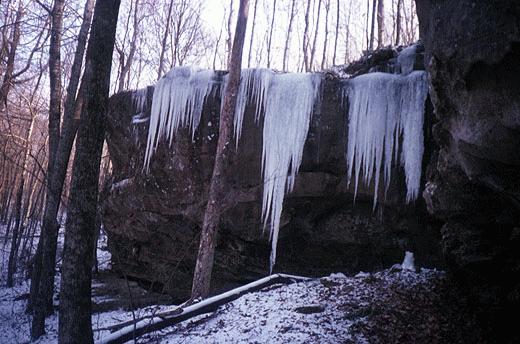
Collie Ridge Bluffs
(photo by William Ewart) |
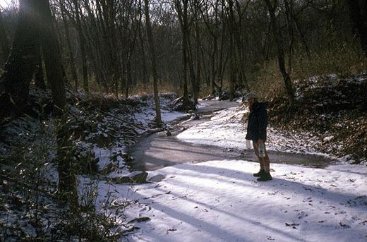
Anyone have a sledgehammer
to crack through the ice for drinking water ??
(photo by William Ewart) |
From William Ewart's journal:
It was -5 to -10 degrees this morning at the Houchin Ferry Campground...toes felt numb in am....watch reset itself so unable to tell time. Stoked up the stove for the first time on the entire trip this morning for coffee and to warm up the tent.
I missed the TV people this am and the main group crossing the Green River at 930am on the Houchin Ferry into the Mammoth Cave National Park area. Caught up to the group around 1pm after me leaving around 1045am.
This evening, off by myself again in the hills of the Mammoth Cave National Park. Stayed on the Collie Ridge Trail instead of descending to the Maple Ranger station and on to the park hdqtrs CG. Group is taking 2 rest days at the main campground and I'll arrive there tomorrow and have just 1 rest day. Suppose to be a group tour of the cave tomorrow or Saturday.
Really beautiful up here. After getting ranger's OK to camp in the backcountry and parting ways with Cindy (and borrowing a candle and some rice and granola) at the junction, I've seen no one. Collie Ridge Bluffs with many icecles hanging. Half moon tonight - will go out of tent to take it all in. Regret it's way too cold to play the recorder. Thin but overcast clouds coming from the west - rusty orange rainbow around the moon.
Not much of a map reader, but it looks like on the Mammoth Cave National Park map that I'm 3 miles NE of where I was last night - after hiking 11.2 miles today!! Strange but true...but could also be wrong.
Some people critical these days of Monty for his avoidance of towns...feel his guidance is bumming out a lot of the hikers...critical of lousy campsites chosen...think Monty should take advantage of all towns and find indoor spots. I disagree and would rather camp out and away from towns.
|


